
This morning we drove to Hoover Dam from Las Vegas. More on that shortly.
On the 11th we just traveled from Tucson to Quartzsite. At Quartzsite, we drove out on Bureau of Land Management land, picked a spot and stopped for the night. Didn't bother to unhitch the trailer. Dropped the trailer tongue jack down enough to level the trailer. We were off the next morning for Las Vegas.
The changing terrain has been interesting. There have been lots of mountains, but there is a lot of flat land around them so there's very little climbing involved. Another interesting observation is the coloration. Here in southern Nevada, the mountains are red looking, while many of the mountains in Arizona were dark, or black.
But without doubt, it's been dry, desert country since the Hill Country (Fredericksburg) of Texas.
Last night we went to the Freemont Experience. The Freemont Experience is a revitalization of the down town area of Las Vegas. Las Vegas and the casinos downtown, such as the Golden Nugget pitched in to redo the down town area. Freemont St was US 93, a main thoroughfare through LV. 5 blocks at the end of Freemont St have been turned into a pedestrian mall. Also a barrel vault canopy was erected over those 5 blocks. This vault is covered with computer controlled neon lights, and different pictures, different messages, or even different light shows are displayed. That place is glitz city. US93 is now a multi-lane, interstate quality.

As mentioned at the beginning, we drove out to Hoover Dam. What a sight, and what an engineering marvel. It's hard to fathom the size of the dam and logistics that went into the construction. What's good is the electricity that's generated and sold to mostly Southern California, has paid for the entire building project and continues to pay for the maintenance and all other operating cost.

This shot is looking south down river. That bridge you see is the new by pass. It carries US 93 from Phoenix, AZ to Las Vegas, NV. The US 93 traffic used to snake down to the dam, and cross it on a two lane road. A by pass was being worked on, but 911 caused the worked to moved up. From 911 until completion the by pass, any vehicle was subject to being searched before crossing and some trucks couldn't use it at all..
Even today, just to get to the parking area to visit the dam, all vehicles are searched. I was pulled out of line today in order for the authorities to look under the hard top that covers my truck bed. Of course, all I had in my truck bed was a air compressor, floor jack, 2 generators and about 11 gallons of gasoline to run the generators. :)
And to get into the dam area, everyone must submit to a search. Just like going through an airport security checkpoint. In fact, TSA mans the security checkpoint.
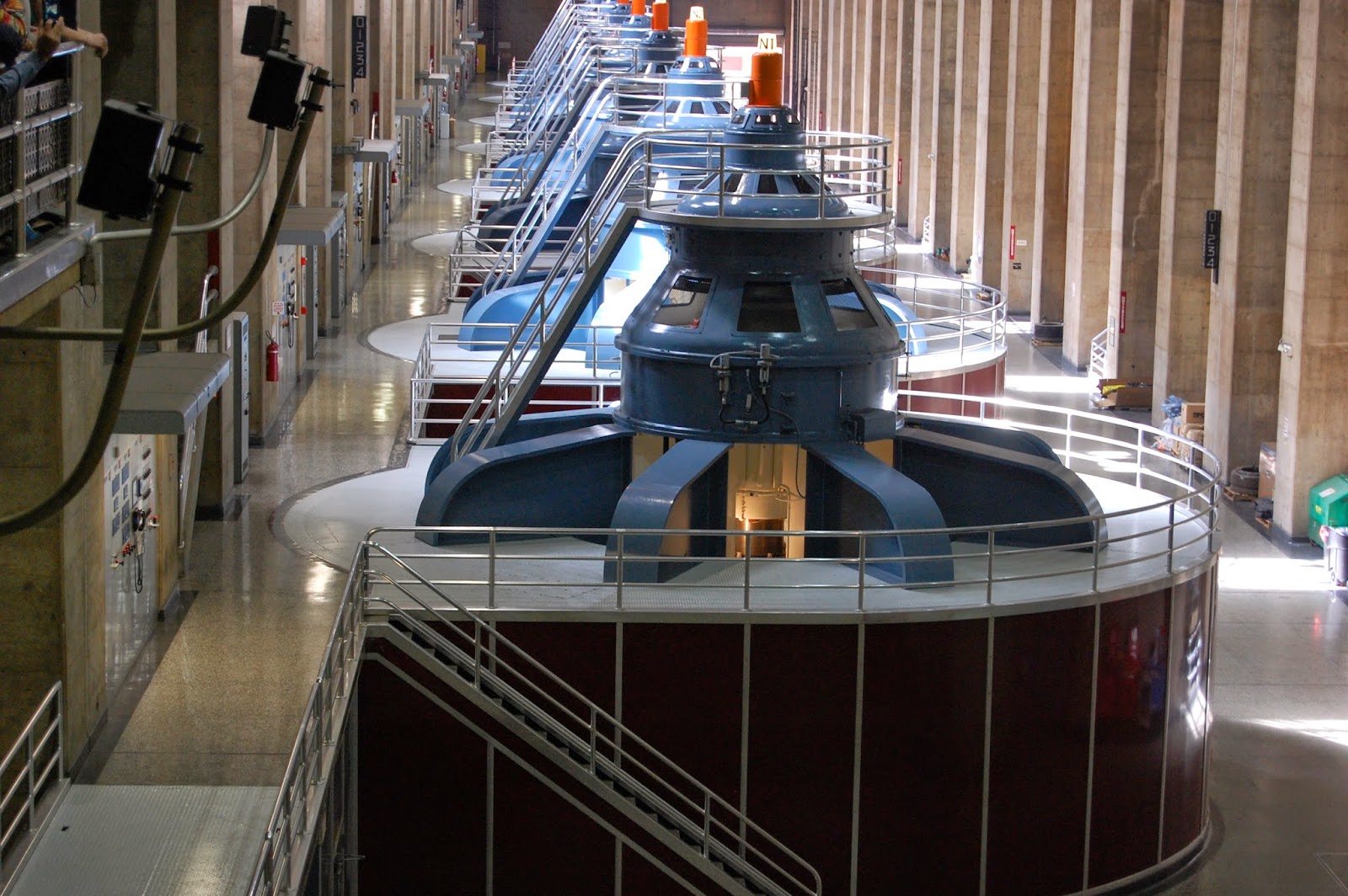
The top photo shows one side of the dam's electric generators. The second picture is Lake Meade, the lake created by the dam. By the water line, one can see how low the lake is compared to earlier times. The 3rd picture is of on the down river side of the dam, with all the electric transmission lines.


This picture is the down river shot, including the new by pass bridge.

One of the original purposes of the dam was to control flooding. A large canal built at the turn of the 20th century supplied water to a large dry valley in California named the Salton Sink which sets astride the San Andreas Fault. This area is only 5 feet higher than Death Valley. This area has been alternately a fresh water lake, a salt lake and dry lake bed. Agriculture bloomed there, until a huge failure of the canal coupled with the flooding of the Colorado River. It resulted in the Salton sea being formed. The water is still there today and is now called the Salton Sea.
Now there are no more floods, and water is supplied to 7 states plus Mexico. The cost of construction of the dam and current operations were and are paid for by selling the generated electricity to the various communities in the southwest. The bulk of the electricity is sold to Los Angeles and other California localities.
Tomorrow we head up to Beatty, NV. We will probably stop here for the night before visiting Rhyolite, a ghost town managed by the Bureau of Land Management. Then we head into Death Valley. If we stop in Beatty, I may have wifi and may do another blog update. If there is no wifi at Beatty or if we go directly to DVNP, there will be no more blog updates until we get to Los Angeles, in about a week.
Until then.
Revised 4/14/14. New pictures and some new narrative.
No comments:
Post a Comment